|
Craig and Lisa's |
Home | Intro | Whitney and Bishop | Bodie and SR-4
SR-88/89 Tahoe | US-50 and SR-722 | Death Valley
| 06/08/05 - Thursday - US-6 and Lunar Crater | |||
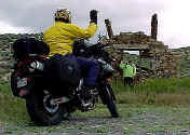 The
stretch of US-50 from Eureka to Ely was quite
pleasant. We posed for a funny pic next to a dilapidated stone house
and enjoyed watching the sun try to break through the overcast morning. The
stretch of US-50 from Eureka to Ely was quite
pleasant. We posed for a funny pic next to a dilapidated stone house
and enjoyed watching the sun try to break through the overcast morning.
We had a bit of a scare at Ely when Lisa noticed the engine covered in places with oil. I looked all over for a source of the oil, perhaps a seal? I couldn't find any pattern or origin at all. After examining the oil caught on the bottom of the front fender we had to conclude we must have just run through some wet stretch of road shortly after someone else had dumped some oil (watched it like a hawk for the rest of the trip though!). |
|||
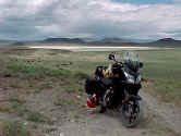
We turned back southwest on US-6, which turned out to be quite a gem after the truck traffic diverted off onto SR-318. Currant Summit was a fun little gently winding descent that ended near the town of Currant, a spooky little abandoned junction. When we passed over Black Rock Summit I
knew we were in for something special. It is hard to describe and even
more difficult to convey in photographs, but with the temporarily lush
terrain I had a feeling we were seeing it as few can throughout the
year. [Note: a few people have asked if we drove across the dry lake pictured (above to the right). No. Niether were there indications that anyone else had recently. We pulled up on an established road to the edge for the photograph.] |
|||
| We came up to a turn off for a spot called "The Wall" - somewhat threatening sounding... but it looked tame enough -- despite the warnings not to proceed by vehicle (can you see where this is going?). So off we go climbing on our little 650cc loaded with two adventurous people and all their gear. Well after all, I did have enough water to hike back to the road in case of a breakdown - and Lisa was all for it. Well the road wasn't to steep overall, but there were a few sections that looked like a dry streambed. With 1st gear a bit too high, I couldn't keep the speed down enough (without slipping the clutch) to really pick my path 100%. That, and we already figured out at Bodie that me standing up didn't "sit well" with Lisa ("What do I hang on to?"). We had a bit of solid clunk on one rock, but for the rest of the trail the clearance was good. When we got to the top I took a peek under the bike and saw what we hit. Good thing we weren't dragging a centerstand. As it turns out we were quite fortunate not to have taken out the stock kickstand for that matter. | The
Suzuki DL650 V-Strom is not a dirt bike. It is a relatively
high clearance standard motorcycle sometimes categorized as a "dual-sport". We've dedicated it's used to what
we would call Adventure Touring. More compromised than
optimized -- everything we select, from tires to safety gear, must
serve us from thoroughfare to ranch road. This trip was a bit of a
test run for man, woman and machine.  We
would like go 2-up to Skagway, AK and Dawson City, YK for example -
but all the trip reports I could find were from solo riders. I wanted
to get a good feel for this bike and how it would handle on long
sections of gravel, dirt, or other road reconstruction areas with 2
people. In taking it to the limit on
this trail I was not expecting it
to perform flawlessly, but rather I wanted to get an idea of the
control issues one faces during low traction or steep climbing with a passenger.
The result we got reinforced what many others have concluded -- It's a
great bike that will accommodate you in many places, but it has it's
limitations: silt, sand, mud, rocks, loose gravel, ice, snow are
formidable obstacles. Care and respect for these should be applied
inversely proportional to how close help is available. Be careful in
any case. We
would like go 2-up to Skagway, AK and Dawson City, YK for example -
but all the trip reports I could find were from solo riders. I wanted
to get a good feel for this bike and how it would handle on long
sections of gravel, dirt, or other road reconstruction areas with 2
people. In taking it to the limit on
this trail I was not expecting it
to perform flawlessly, but rather I wanted to get an idea of the
control issues one faces during low traction or steep climbing with a passenger.
The result we got reinforced what many others have concluded -- It's a
great bike that will accommodate you in many places, but it has it's
limitations: silt, sand, mud, rocks, loose gravel, ice, snow are
formidable obstacles. Care and respect for these should be applied
inversely proportional to how close help is available. Be careful in
any case.
|
||
|
As we got back down and continued on
towards the main road (or so we estimated by compass) we turned a
corner to an awesome site - a huge crater! It was so big it even had it's own rain
cloud dropping down inside when we got there. 274.8
miles for the day, of which
22 was
dirt. -- Next, Death
Valley and homeward |
|||
 A hardy breed, but not a low enough 1st gear to maintain an appropriate controllable speed in steep or rocky portions of the trail without over using the clutch. |
 "The Wall" hath taken away... |
 As better judgment kicks in, Lisa is issued her walking stick and asked to hike back down... |
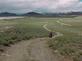 Craig solos down "The Wall" |
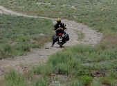 A bit too heavy 2-up with gear on just a few little sections -- and that would be all it would take! |
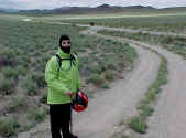 Lisa more than happy to oblige! |
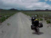 The Nelson-Rigg SB-900 Saddlebags mount low and tight - with rain covers they make a good bag for off-road conditions (keeps them clean wet or dry). |
 Lisa in the pose of the trip. Our Storm chasing Strom... |
|
|
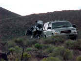 Shared some info with these guys at the crater. They had a better map, and I kept them from overshooting their last possible gas stop. They had planned to refuel at Currant which is currently abandoned. |
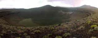 The Crater!! Thanks to Michael for processing this image from 4 separate photos (It was in rough shape, having been shot in the rain) |
|
|
|
|
 Nice to have the rain covers on just to keep the bags clean... |
|
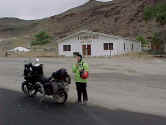 Deserted Warm Springs. Notice my dirty footprints all over the fresh asphalt? |
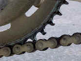 Loobman doing it's job on the critical part of the drive chain and sprocket after a run in the dirt |
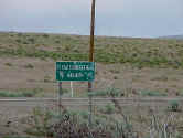 ET Highway junction at Warm Springs |
|
Next, Death Valley and homeward
See more than you want at: http://profiles.yahoo.com/sandiegoland