|
Craig and Lisa's |
Home | Intro | Whitney and Bishop | Bodie and SR-4
SR-88/89 Tahoe | US-6 and Lunar Crater
| 06/08/05 - Wednesday - US-50 and SR-722
We would wake to find the day a wet one. We deployed all rain covers and donned full rain regalia, this time to stay dry, and said goodbye to Carson City in the rain. I saw quite a few things early in the morning I would have liked to photograph, but the rain made it a bit difficult. For example the berm alongside the road through Salt Wells Basin is covered with messages written in roadbed rock. "marry me," "JB+CL," etc... US-50 to SR-722, then US-50 again to Austin. SR-722, part of the original US-50, made this leg of the trip. Met up with Brad from Elko, visited Stokes Castle and then continued on to visit an electricity-free ranch near a Pony Express Station. Had dinner with Brad at the Owl Club before he departed for home. Before we headed back to the Sundown Lodge for the evening, Lisa dropped by the gas station next door and picked up a free copy of the official Nevada State map. Niether on our AAA map or MS Streets and Trips, I spotted a short little dirt road on this new map going to a place called Lunar Crater that sparked my interest...hmmm...tomorrow perhaps? 264.4 miles for the day, of which at least 10 was dirt. -- Next, US-6 and Lunar Crater |
 And so the rain begins... |
 Salt Wells Basin See Pashnit |
 Local issues: BLM not so popular? |
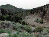
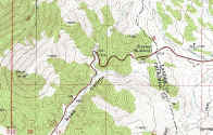
 SR-722 near Carroll Summit. Find this curve in the map and sat image below: |
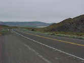
 SR-722 is a must see and a far lonelier highway than US-50. |
 Here you can see the cool twists before Carroll Summit. |
|
Stokes
Castle outside Austin. At |

|
 Brad on dirt. |
Next, US-6 and Lunar Crater
See more than you want at: http://profiles.yahoo.com/sandiegoland